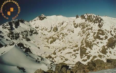
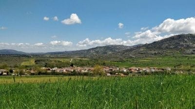
The Sierra de Gredos Natural Park is right on our doorstep: a spectacular landscape of glacial lakes, gorges, cirques and crags, home to the Iberian ibex.
If the city of Ávila is the first place we recommend, the Sierra de Gredos comes next. It is about 35 km from Robledillo. Gredos is the central and highest part of the Sistema Central mountain range, a huge granite massif shaped by glaciers. Spring comes late to the high ground, with the mountains in full bloom in June and July, and the nearby valleys are lush thanks to the abundant snowmelt.
Hoyos del Espino
Monuments:
- Marian sanctuary: The sanctuary church of Nuestra Señora del Espino is a Romanesque church with a Gothic interior: a single nave with a rib vault and an 18th-century Renaissance-Baroque main altarpiece. It houses a Romanesque carving of the Virgin.
- Gothic wayside cross: A pointed Gothic cross, one of the best preserved in the Gredos area, decorated with rows of balls typical of the 15th century. The projecting bracket probably once held a statue, now lost.
You can also see the school clock and several fountains and troughs.
Places of interest:
- Park visitor centre (Casa del Parque): The visitor centre has information on many routes and ways to discover the Sierra de Gredos Natural Park. A must.
- Swimming spots: There are many river swimming spots to enjoy in July and August; the best are La Piscina natural, Las Chorreras, Puente de las Juntas, Pozo de las Paredes and Valdeascas.
- Scenic spots: These places are also ideal for a stroll or great photos: Puente del Duque, Las Chorreras, Pozo de las Paredes and the Plataforma de Gredos.
Route details
- Location: 42 km from Robledillo
- Getting there: From Robledillo take the N-502 to Venta Rasquilla, then turn onto the AV-941 towards El Barco de Ávila and continue to Hoyos del Espino.
- Tourist information: At the start of the Plataforma road, next to the ibex monument, the tourist information centre has useful information on Hoyos del Espino, the neighbouring villages and the Sierra de Gredos. 750 metres up the Plataforma road is the Casa del Parque, the Sierra de Gredos visitor centre.
- Tourist offices: Hoyos del Espino: +34 920 34 90 35
- Links: http://www.hoyosdelespino.net/


Navarredonda de Gredos
Monuments:
- Church of Nuestra Señora de la Asunción: A 16th-century late Gothic church built of dressed stone.
- Church of San Benito Abad (Barajas) The parish church of Barajas stands at the entrance to the village, right by the Navarredonda road.
Walks:
Walk to the Piedra del Mediodía, the source of the river Tormes, the pine forest trail…
Route details
- Location: 38 km from Robledillo
- Getting there: From Robledillo take the N-502 to Venta Rasquilla, then turn onto the AV-941 towards El Barco de Ávila and continue to Navarredonda de Gredos.
- Tourist information:
At the start of the Plataforma road, next to the ibex monument, the tourist information centre has useful information on Hoyos del Espino, the neighbouring villages and the Sierra de Gredos. 750 metres up the Plataforma road is the Casa del Parque, the Sierra de Gredos visitor centre.


Hiking routes in Gredos
The Sierra de Gredos Natural Park, right on our doorstep, has superb hiking routes through beautiful scenery and dreamlike spots.
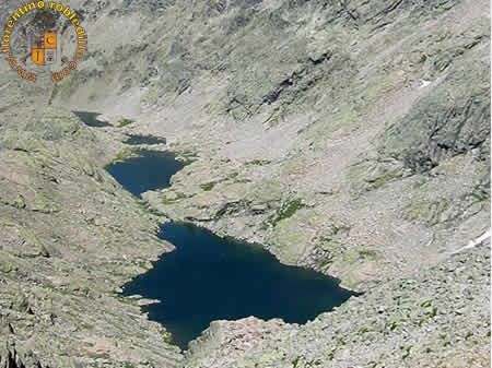
Gredos has many routes through a striking granite landscape carved by glaciers: lakes, cirques, gorges, moraines, crags, pinnacles and knife-edge ridges, culminating in the 2,592 m Almanzor peak. Besides its natural value, the area is full of places where history, art and tradition have left their mark. The main trail leads to the Trocha Real, which in a few minutes brings you to the foot of the great glacial lake, whose cold, clear waters reflect the peaks that form the Circo de Gredos with Almanzor: Risco de la Ventana, Los Tres Hermanitos, Cuchillar de las Navajas and El Sagrao.
Laguna Grande
Route details
- What it is: Glacial cirque with a lake inside.
- Difficulty: Easy to moderate
- Altitude: 1,930 m
- Maximum ascent: 420 m
- Distance: about 15 km return
- Approximate time: 5 hours return.
- Starting point: Plataforma de Gredos. From Robledillo take the N-502 to Venta Rasquilla, turn onto the AV-941 towards El Barco de Ávila and continue to Hoyos del Espino, where the AV-931 road climbs to the Plataforma de Gredos car park, the start of the walk.
- Route: At the far end of the car park a cobbled path (an old Roman road) climbs to Prado Pozas and the Reguero Llano hut. At the top, do not head for the hut: cross the meadow westwards to the bridge over the Pozas stream. From there the climb to Los Barrerones (2,170 m) is well marked. Once at the top, the path descends and turns south, with some steep sections. When you see the lake, go round it on the left (east side) to reach the Elola mountain hut.
- What to bring: Nothing special: boots, a water bottle and food for the day. Bring warm clothes even in summer, as it can get cold in the evening.
- Notes: There is a spring (Fuente de los Cavadores) on the east side of Los Barrerones, near the top on the left as you climb, and another halfway down the west side. At the lake you can drink from the streams flowing in, but not from the lake itself or its outflow. The Elola hut serves breakfast, lunch and dinner and is open all year.
Following the stream that feeds the lake, you reach the Charco de la Esmeralda, a perfect spot to cool off in crystal-clear, blue-green water. - Links:


Almanzor peak
Route details
- What it is: Large scree fields and steep climbs.
- Difficulty: Moderate to hard
- Altitude: 2,592 m
- Maximum ascent: 846 m
- Distance: about 20 km return
- Approximate time: 10 hours return.
Starting point: Plataforma de Gredos. From Robledillo take the N-502 to Venta Rasquilla, turn onto the AV-941 towards El Barco de Ávila and continue to Hoyos del Espino, where the AV-931 road climbs to the Plataforma de Gredos car park, the start of the walk. - Route: Follow the Laguna Grande route to the Elola hut. From there, take the cairned path south-south-west to the Hoya de Antón. The gully on your right is the Portilla Bermeja, which you climb; a little over halfway up there may be a snowfield, and on the right you will see a narrower, steeper gully leading to the south side of Almanzor: the Portilla del Crampón. Climb it, and at the top a short scramble to the right takes you to the summit trig point.
- What to bring: Nothing special: boots, a water bottle and food for the day. In winter, crampons, an ice axe and warm clothing are essential.
- Notes: In snowy years there is still a snowfield halfway up the Portilla Bermeja in summer where you can get water; in other years there is no water between the hut and the summit, so carry plenty. The last stretch of the Portilla del Crampón can be tricky because of loose stones and grit.

Cinco Lagunas (Five Lakes)
Route details
- What it is: Glacial lakes.
- Difficulty: Moderate
- Altitude: 2,100 m
- Maximum ascent: 910 m
- Distance: about 16 km return
- Approximate time: 7 hours return.
- Starting point: Bridge over the river Tormes at Navalperal de Tormes
- Route: Just after the bridge (reachable by car), take the track climbing to the right. About 1 km later it drops to cross the bridge over the Navalperal gorge and climbs again to the left. Take care: some 500 m further on, at a sharp right-hand bend, leave the track for a narrow path straight ahead that returns to the gorge and crosses it on a footbridge. After it, take the right-hand path and follow the cairns up the left bank of the right-hand gorge. After about an hour you reach the Chozo de la Barranca shepherds’ hut, where the path climbs steeply to the left into another glacial cirque; from there climb again into the next cirque, also on your left, where the five lakes lie. There is no path on this last stretch, so follow the water flowing down from the lakes. If you still have energy, head south up the Portilla de Cinco Lagunas (just over half an hour) for a magnificent view of the southern plateau.
- What to bring: Nothing special: boots, a water bottle and food for the day.
Notes: There are hardly any springs on the way, so bring full water bottles or drink from the gorge.


Climb to El Morezón
Route details
- What it is: Grass and broom.
- Difficulty: Easy to moderate
- Altitude: 2,393 m
- Maximum ascent: 643 m
- Distance: about 14 km return
- Approximate time: 6 hours return.
- Starting point: Plataforma de Gredos, at the end of the road from Navacepeda de Tormes
- Route: Climb to Prado Pozas as on the Laguna Grande route, then head south up the right-hand side of a gentle ridge, following the cairns, with the Pozas gorge and the dark rock walls on your right. At the top the path forks: the left branch, level and slightly downhill, leads to the ruins of the Refugio del Rey; the right branch, cobbled in places, leads towards Navasomera. Leave the cobbled path here and climb to the pass to the south. From the pass, El Morezón is an easy climb on your right, with the Risco del Fraile on your left.
- What to bring: Nothing special: boots, a water bottle and food for the day.
- Notes: El Morezón offers what is perhaps the best view of the Circo de Gredos, with the lake below. From the ruins of the Refugio del Rey you can see Castilla-La Mancha and Extremadura; the most striking peak to the east is La Mira. There is a good spring at the Refugio del Rey, and water at Navasomera (the source of the Pozas stream).