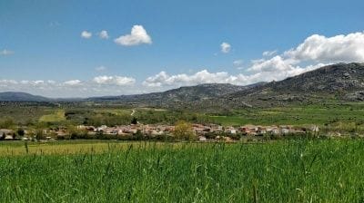
The Castro de Ulaca is the walk around Robledillo. It is an important Vettonian site near Villaviciosa, combining cultural heritage with stunning views over the whole Amblés Valley.
The Castro de Ulaca is a Late Iron Age settlement in the province of Ávila, in the municipality of Villaviciosa. Ulaca was the most important settlement in the whole region before the Roman conquest and is one of the most remarkable Celtic hill towns in Europe.
The Castro de Ulaca is just 3 km from Robledillo, above the village of Villaviciosa. You can drive to the foot of the hill, then walk up for about 30 minutes. It is without doubt the most impressive of the Vettonian hill forts and one of the most interesting Celtic oppida (fortified towns) in Europe, for its features, its position overlooking the whole Amblés Valley and the remains it preserves.

It sits on a high granite hill at over 1,500 m. From the top there are wide views in every direction, especially north, over the whole Amblés Valley and the river Adaja, and south, where the massive Sierra de la Paramera rises. It was probably a shared sanctuary that was fortified under Roman pressure and became an important walled town, apparently abandoned around 72 BC, probably as a result of the Sertorian Wars.
It covers more than 60 hectares, with several enclosures surrounded by substantial walls over 3 km long, reinforced in places by additional lines of wall, although these are quite ruined.
The town of Ulaca
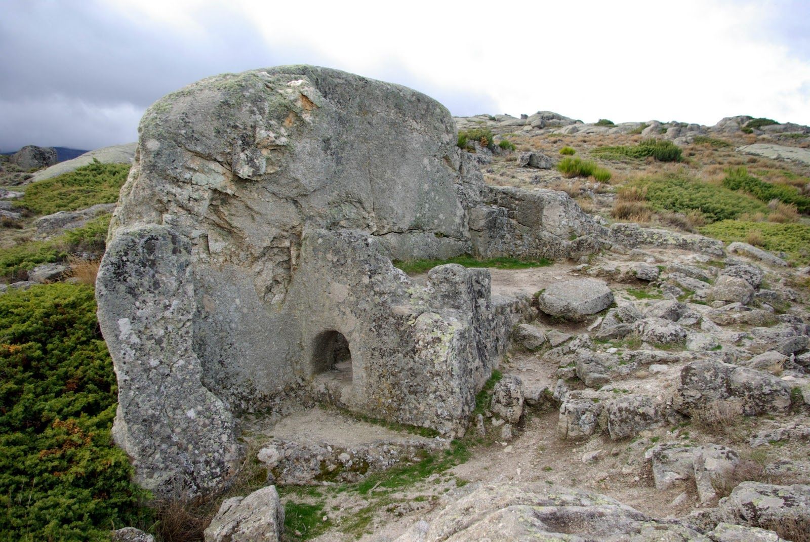
Sacrificial altar: carved into the granite, it is one of the best-preserved traces of the spiritual world of the Vettones. It is an irregular enclosure dominated by a prominent rock into which a double staircase has been cut, ending at the top in several hollows thought to be linked to rituals, perhaps sacrifices.


The wall: the wall around the town follows the lie of the land in a perfect blend of human work and nature. There are nine entrances, or at least nine gaps in the wall, of which two gates survive: the north-west gate, which seems to have been the main entrance as it was protected by several lines of wall, and the north-east gate. The wall does not seem to have been purely defensive, since in places it relies on natural cliffs, so it was probably also a symbol of prestige and a territorial boundary.
Sauna: the stone structure near the altar has been interpreted as an initiation sauna, because of its shape, its similarity to saunas in north-western Iberia and what the Greek geographer Strabo wrote about them. It has three parts: a furnace chamber, a steam room with a bench cut into the rock, and an antechamber, perhaps for preparing before going in.

The houses: about 250 houses have been found, not counting those scattered outside the wall. There is no street plan, as the houses are placed to fit the uneven ground. They are square or rectangular, from 50 m² to 150 m², and usually have two or three rooms: one held the hearth and was the main living space, while the others may have been stores or sleeping areas. Some houses have extended walls that suggest porches, entrance halls or perhaps animal pens.
There are also groups of larger, adjoining buildings whose purpose is still unclear: they may have been communal spaces or perhaps homes of the elite.
Granite quarries: there are two quarries, one to the west, which supplied the stone blocks for the houses, and another to the south-west, where the stones for the wall were cut. They are among the most evocative spots in Ulaca: half-extracted, half-carved and even finished blocks seem to be waiting for the stonemasons to come back to work at any moment.

Route details
- Location: Villaviciosa, Ávila
- What it is: Iron Age Celtic settlement.
- Period: Iron Age (around 500 BC)
- Distance: 5.5 km from Robledillo, 7.5 km by road
- Getting there: Take the N-502 towards Ávila as far as Solosancho, where there is a turning to Villaviciosa. In Villaviciosa, go straight along Calle Ulaca between the tourist office and the church; from there a dirt track climbs the hillside. After the first climb and a few bends the track widens, and on the left there is an information point and a green gate. Leave the car here and continue on foot.


- On foot: From the car park, a path climbs the hillside; at the top you can see the gate in the wall through which you enter the fort. The route is marked with small yellow-painted granite posts and follows the easiest way up. The site is set up for visitors, with information boards at the most interesting points.
- Approximate time: 1 hour up and down, plus at least 1 hour to visit the site at the top. The walk is a great way to combine exercise, nature and scenery, and the history of the Iron Age people who lived here.
- Difficulty: the climb has some steep slopes, and a relaxed ascent takes 30 to 40 minutes. Trainers or walking shoes are strongly recommended.